Category: Road Tripping

  • California Coast Line – San Diego to San Francisco

    California Coast Line – San Diego to San Francisco

    Driving the California Coast in a convertible!  It’s the California dream, right?  I’m lucky enough to live in the LA area and own a little convertible Miata. So, here is my list of my favorite places to stop while driving along the coast.  This article is meant to be a sampler of places to visit. Based on your likes, you may want to dive deeper into a particular city so I’ve included a lot of links. Have fun and make your own memory driving the California Coastline. 

    Going north to south, these are my suggested stops.

    • San Francisco
    • Monterey
    • San Simon
    • Morro Bay
    • Pismo
    • Santa Maria/Lompoc
    • Solvang
    • Santa Barbara
    • Ventura
    • Malibu
    • Santa Monica/Venice
    • Long Beach
    • Huntington Beach
    • Laguna
    • San Diego

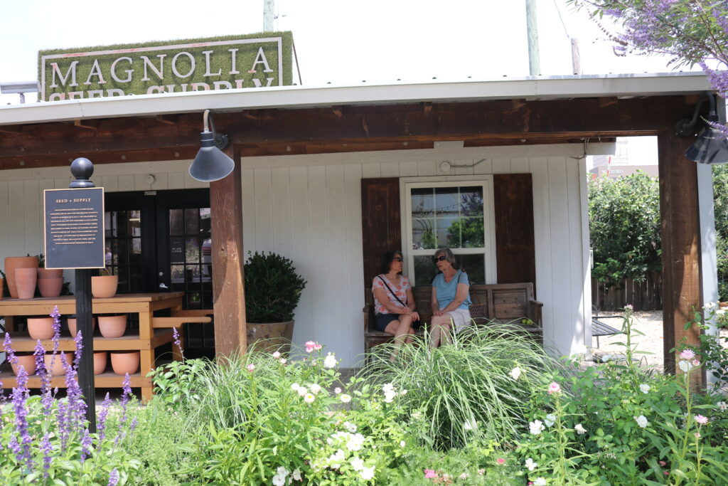
    San Francisco: The City by the Bay

    San Francisco has so many places to see, you have to prioritize your choices.  I love this City and visit often but still haven’t seen it all. Here are some of the highlights.

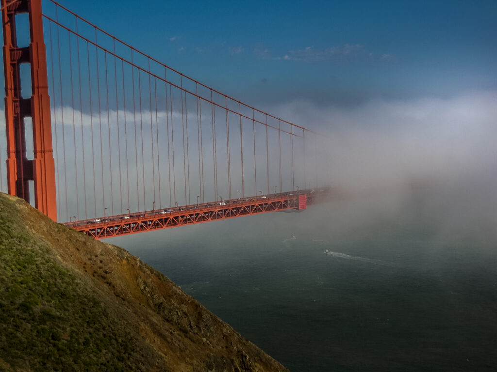
    Walking across the Golden Gate Bridge. You can get a view like nowhere else by walking across the bridge.  Often this walk is chilly as the natural breezes and the fog can blow off the Pacific Ocean so you might want to see if you need a jacket before you set off.

    From the Sausalito, or northern side of the bridge, you can look back at the City skyline and watch the sail boats. The walk is loud and noisy with all of the cars racing by but pedestrians have their own protected path so it’s safe and easy to leave all of that behind to enjoy the view.

    Afterward, relax in Chrissy Field, take a nap, another selfie with the bridge behind you or watch people flying kites.  The Painted Lady Homes are also near here. At this end of the Bay is the Walt Disney Family Museum with hours upon hours of sight-seeing memorabilia collected by Walt and his daughter who has a home here.  The Ghiradelli Chocolate store is right up the hill if you’re hankering for something sweet and close by is the end of the cable car track so you can literally watch the workers turn the cable cars turn around. 

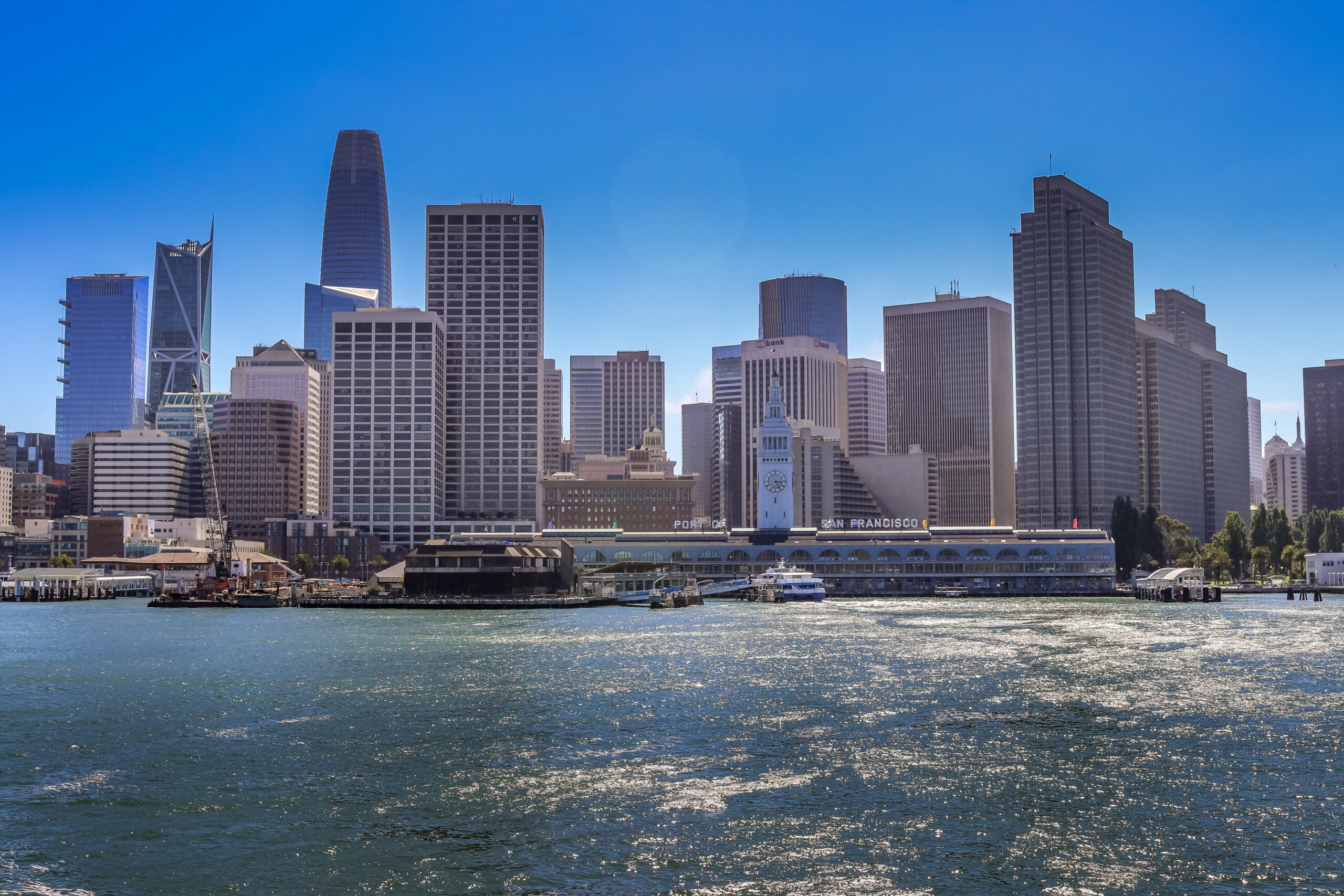
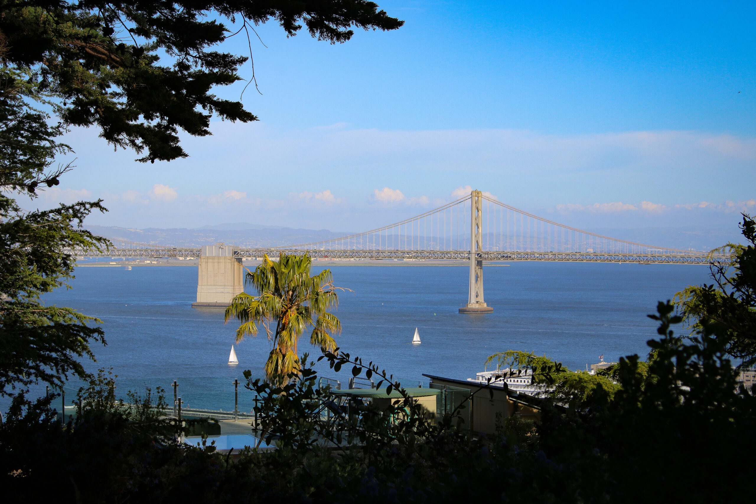
    Walking along the bay from Chrissy Field, you pass Fisherman’s Warf, Pier 39 and can walk down along the Embarcadero.  If you go out on the piers, you can see and hear the seals barking, smell the fisherman’s catches, eat clam chowder in a bread bowl at one of the many restaurants and visit the Ferry Building filled with small shops and gourmet foods. If your feet are exhausted from all this walking, you can always hop a cable cars that travels parallel to the Bay. From the east end, you can see the Bay Bridge, which is my favorite at night when they turn on the LEDs, fish float alongside the bridge in lights.

    Another option is to take a tour on boat under the Golden Gate or visit Alcatraz Island, the notorious prison that claims it was impossible to escape or spend the day at the California Academy of Sciences.  They have more than 20 exhibits daily and you can spend hours here.

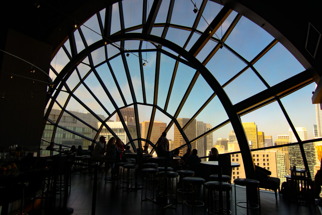
    If you’re really up for a hike, walk up hill to Lombard Street, the curviest street around or to Coit Tower for an unbelievable view.  Want the view without the walk, I’d suggest a drink at The View Lounge at the Marriott. -Make sure you get there when it first opens for the best seat.

    Monterey: Cannery Row

    One of Monterey’s claim to fames is John Steinbeck who wrote many novels here including Cannery Row. Many of the canneries are now restaurants and shops that you can browse through.  Monterey is also known for its world-renown aquarium.   The Monterey Bay Aquarium is huge and the best that I’ve been in.  You can touch a starfish, poke a sea anemone and see humongous fishes swimming all around you.  One of my favorite things to watch here are the jellyfish that slowly glide through the water.  Monterey is also along the whale migration route and in the spring, you can go out on a boat whale watching.  On our trip, we saw a few whales but what was more fun for me was the hundreds of dolphins that followed our boat, riding along our bow.  One must do is the 17-mile drive in Monterey.  Pebble Beach is here and the curvy road goes along some of the most beautiful coastline in the world.

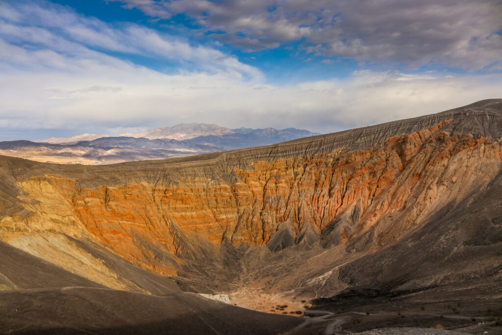
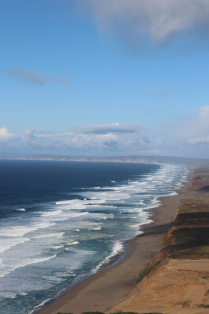
    Big Sur: Pfeiffer Big Sur State Park

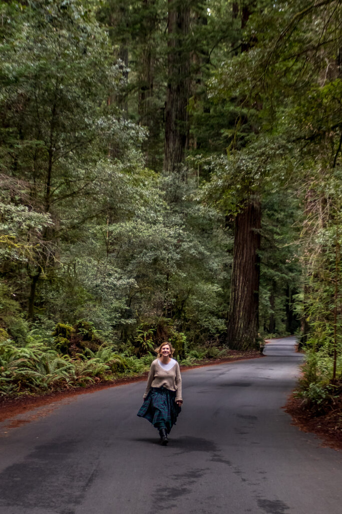
    If you haven’t had your fill of hiking yet, stop in Big Sur for a walk within the State Park.  There are huge Redwood trees and plenty of hikes to choose from.

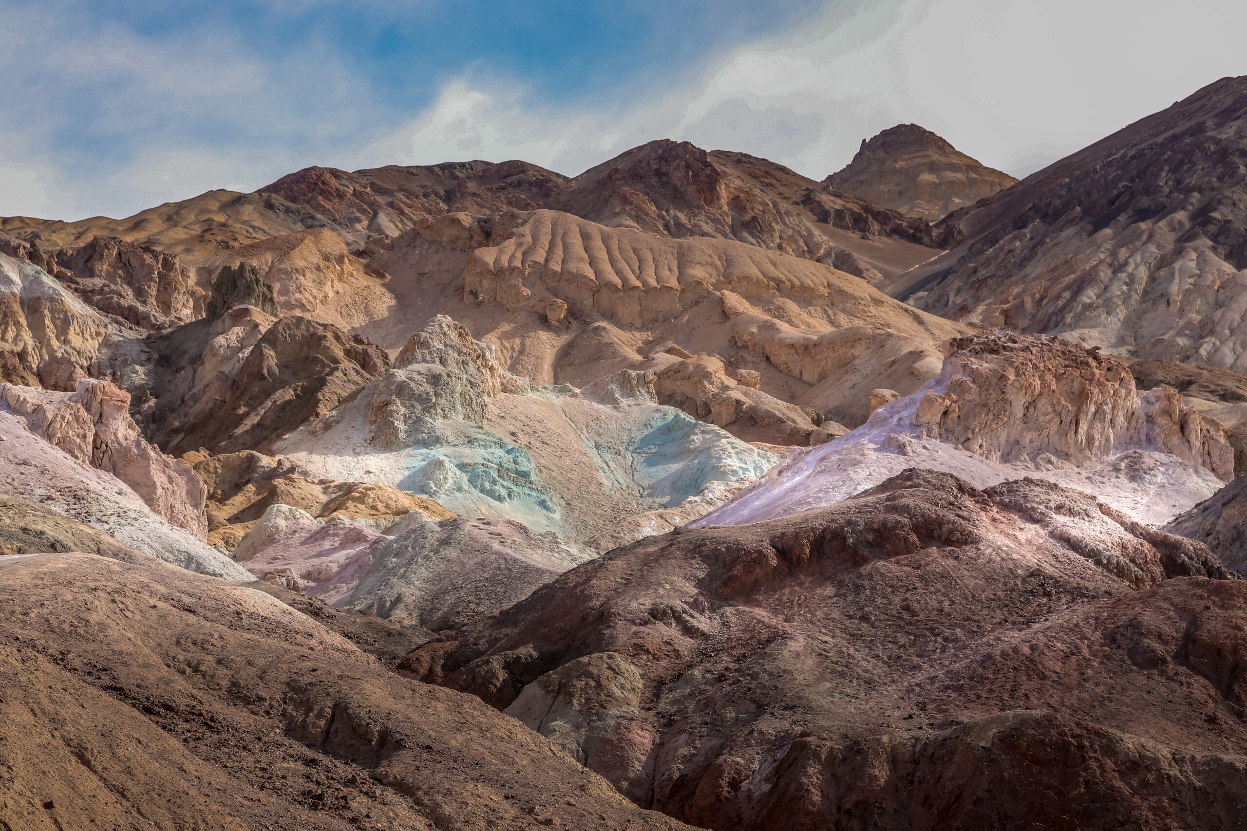
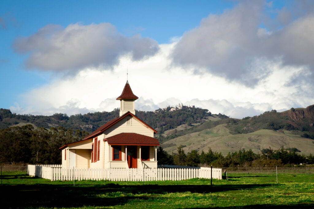
    San Simeon: Home of Hearst Castle

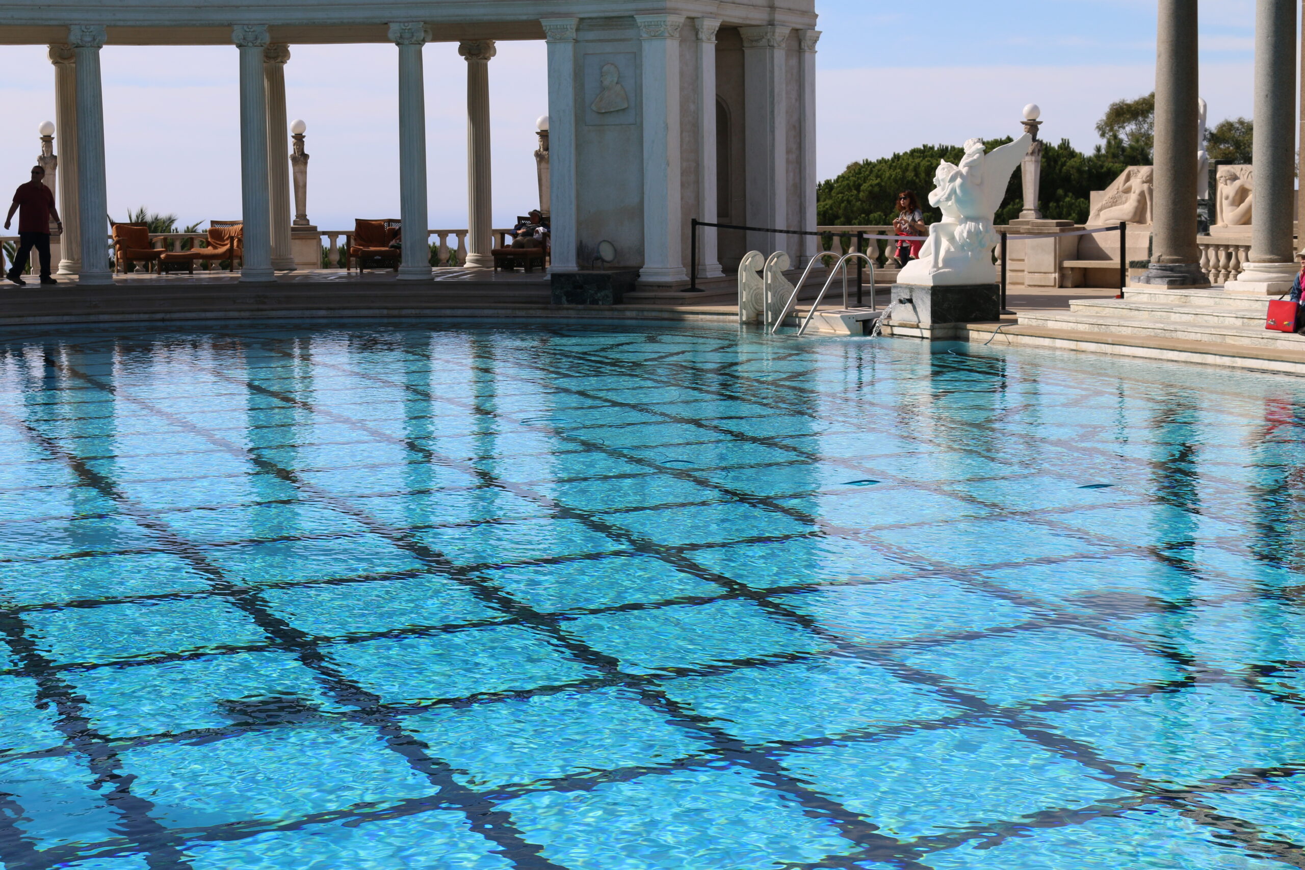
    William Randolph Hearst was a newspaper and media mogul who control much of the newspaper messaging during the late 1800s/early 1900s, relying on sensationalism and crude exaggeration, he was either loved or hated by his readers. Yes, Patti Hearst is his granddaughter.  With his millions of dollars and an inheritance, William Randolph creating Hearst Ranch, a spread that included 250,000 acres and building Hearst Castle designed by architect Julia Morgan, By 1947, included 165 rooms and 123 acres of gardens, terraces, pools and walkways and was still considered unfinished.  You a take a variety of tours. 

    I also recommending stopping at Hearst Ranch Winery on your way out or beforehand.  It sits on the westside of Highway 1 next to the beach and has some really good wines.  This is one of my “must stops” for wine lovers along the way.

    Morro Bay: The Big Rock

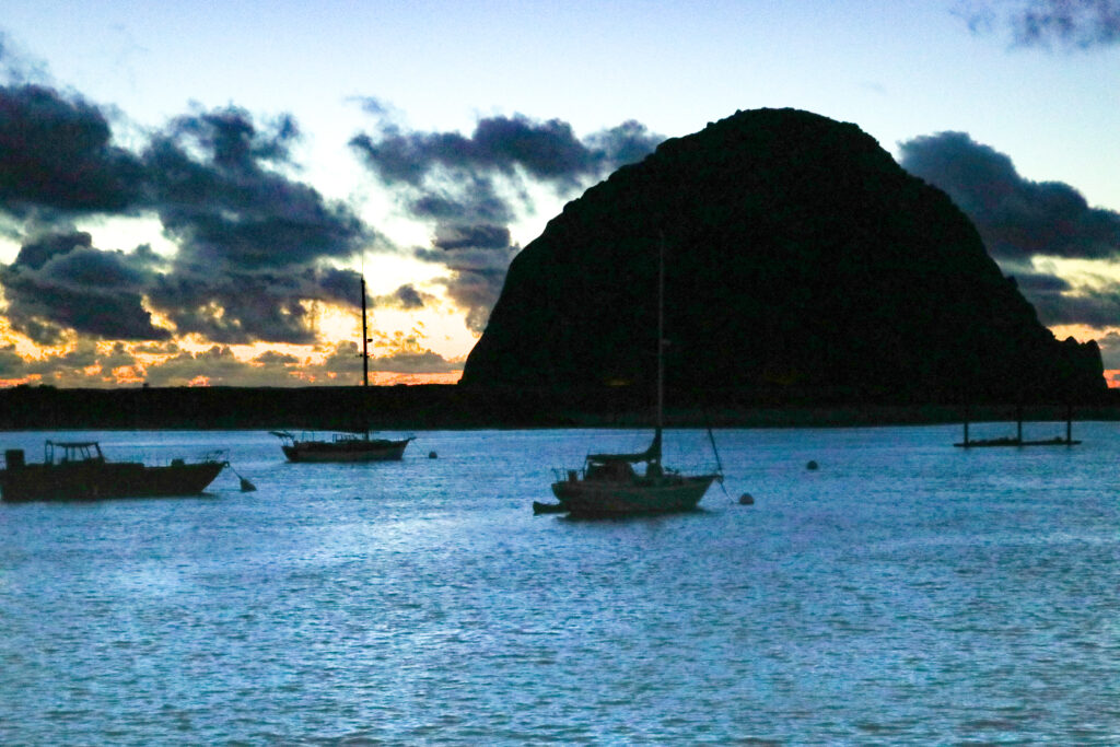
    Morro Bay is the epidemy of a smaller beach town and I love it.  Looking out to the bay is Morro Rock, a huge bolder that springs up out of the water and gives the town its name.  Along, the water are small shops and places to eat.  This town has a lazy layback feel and you can sit and watch the sea otters, seals and birds play in the bay for hours, especially in the morning before it gets busy.  If you’re more energetic, walk the rock!

    Pismo: Drive on the Beach

    Pismo Beach is another small beach town and is super popular with sports enthusiast.  This is the only area in California where you actually drive on the beach, so its worth spending some time here.   There are about 3,500 acres of sand dunes at the Oceano Dunes SVRA/Pismo State Park that also offers camping.   As you cruise the sand, there will be plenty of people watching with See-Doos jumping the waves, dune buggies and quads racing around and kites flying high.  You can also dig up the famous Pismo Clams but make sure you have a license.

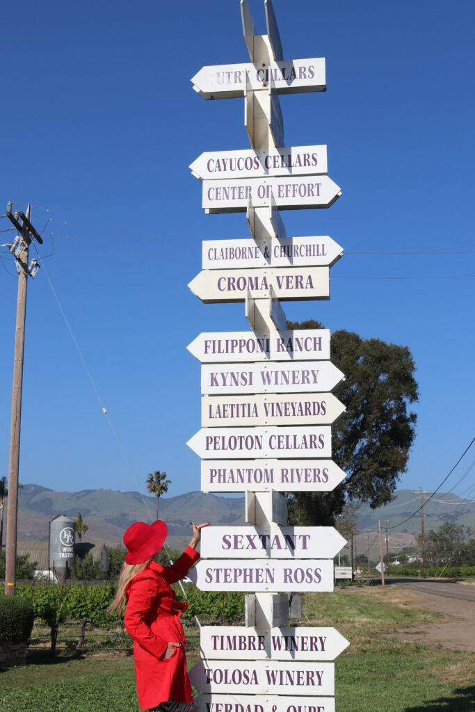
    Santa Maria/Lompoc: Wineries

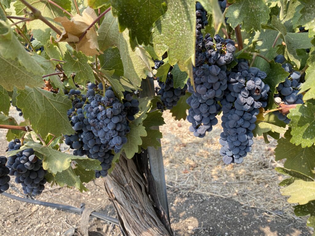
    When you get to Santa Maria/Lompoc area, the highway cuts inland and I suggest you go a little further to go wine tasting in this area.  The Edna Valley and San Luis Obispo wine regions are world renown for their many award-winning wineries and tasting rooms.  Some of my favorites are listed in this blog post.

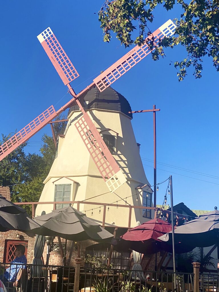
    Solvang: Get your Danish On

    Solvang is next.  It’s a Danish town with windmills and cute Danish cottages that host shops and restaurants.  If you can’t make it to some of the local wineries, Solvang also has lots of tasting rooms so you can sample many of the local wineries at once.

    Santa Barbara: Highend Eating and Shopping

    Santa Barbara is a mission style town along the beach.  This town is expensive to live in and reflects a more sophisticated lifestyle. The downtown offers many gourmet eateries that you can sit outside and enjoy the dependably wonderful weather. Or attend an array of events offered each weekend.  Santa Barbara also has some really good farmer’s markets for you to enjoy. If your camping and can get reservations at Gaviota, Emma Wood (no tent camping) or Carpenteria, book it now, as they fill up fast and are right on the water. Santa Barbara is hosts one of the California Missions that were built up and down California to provide housing and sanctuary for the Catholic priests of the Franciscan order.  There are 21 missions and Santa Barbara’s mission is called the Old Mission San Barbara and offers tours.

    Malibu: Home of the Rich and Mega Rich

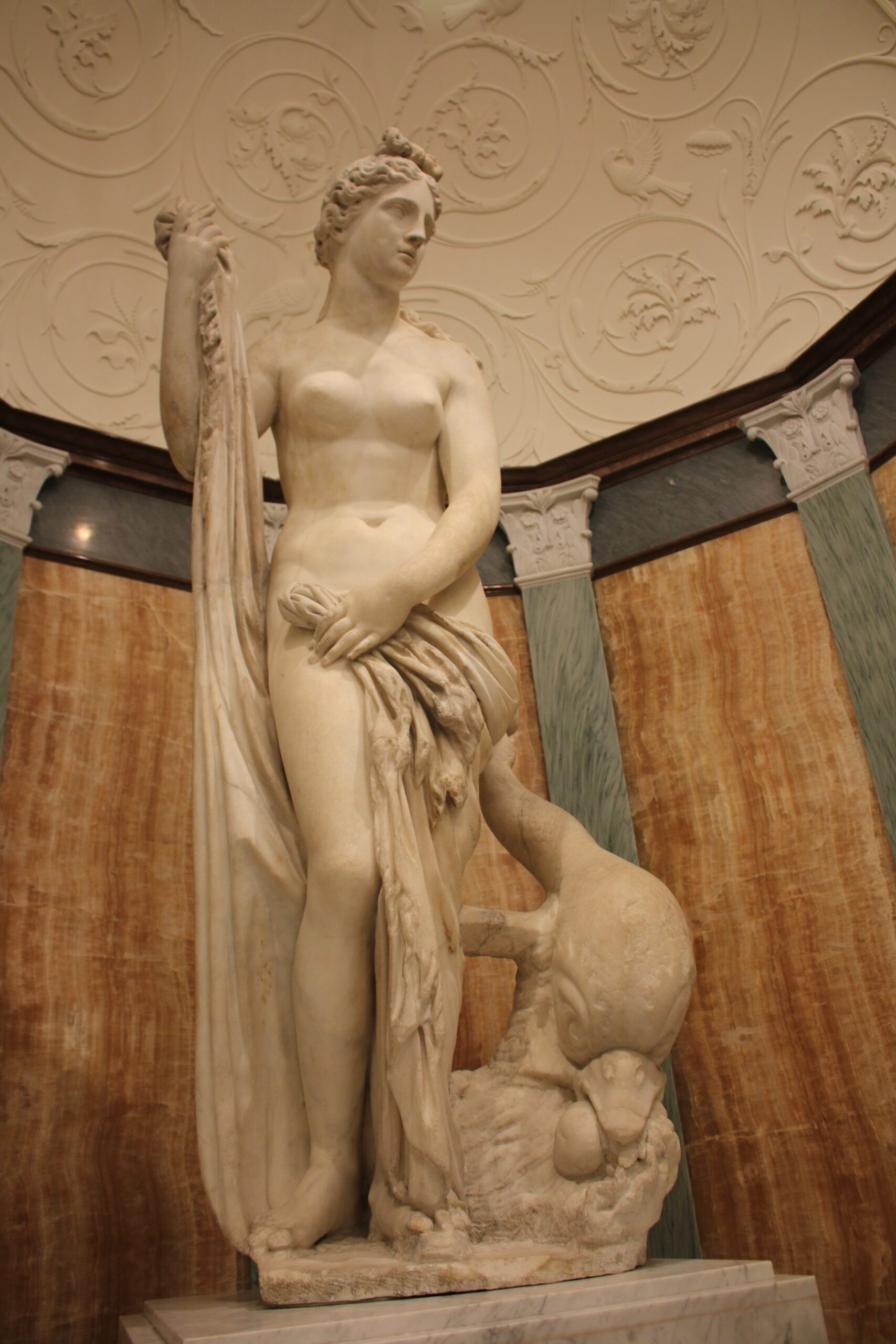
    Malibu goes on forever with some of the most beautiful ocean front property around.  Much of it is fronted with homes so you can’t see the beach as you drive along it but get out of the car and walk though one of the public access areas to the water, (look for the little signs) you get to not only view the Pacific to the west can see some huge homes to the right.  Malibu is also home to the Getty Villa. Paul Getty, an oil magnate, built the Getty Villa adjacent to his home to house his art collection.  Today it acts as an educational center and museum dedicated to the study of the arts and cultures of ancient Greece, Rome, and Etruria.  The tickets are free but you need to order them early and pay for parking. There are many events held at the Getty include Greek plays in the outdoor auditorium.  You can spend an entire morning or afternoon roaming the gardens and art collections.

    If you have time to go inland, visit Malibu State Park and go hiking in the hills.  There is a vast array of trails to choose from.

    Santa Monica: Home to the Famous Pier and Ferris Wheel

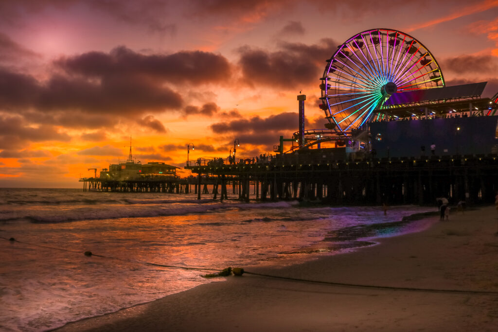
    Santa Monica is known for the Santa Monica Pier and Pacific Park.  Located right on Pacific Coast Highway (the 101) freeway, a walk along the pier, especially at sunset is fun. There are shops along the pier and the famous Ferris wheel in Pacific Park (This is the one you often see in Hollywood movies) along with a small rollercoaster and midway.  At the end of the Pier are fishermen and the Marisol (Mexican) restaurant. Get there early if you want a table at sunset. If you travel eastward from the Pier, there are a large amount of national and local chain restaurants and shopping at Third Street Promenade

    Venice Beach: Street Performers, Musclemen & Women

    Venice Beach is just south of Santa Monica and it resembles your eclectic, hippy black sheep brother-in-law.  It’s a fun area with street performers, small shops and the home of Muscle Beach although Santa Monica also claims their own Muscle Beach too. Many years ago, when I was here, there were a ton of people smoking marijuana.  This was before it was legal in California and it was rampant. There are plenty of homeless here too, although I’ve heard the have been cleaning up the area and removing encampments. You may want to think twice before bringing your kids here.

    Long Beach, Ports, an Aquarium and the Queen Mary

    Long Beach is home to the RMS Queen Mary and Long Beach Aquarium. The Port of Los Angeles is comprised of the Port of LA and the Port of Long Beach.  It’s one of the world’s busiest seaports for international trade in North America and the number one container port in the U.S. with 9.5M containers handled in 2018.  Within Long Beach is also the RMS Queen Mary.  It now acts as a hotel, museum and restaurant.  It needs some maintenance but if you are into haunted old ships, this is the place for you.  The ship was delivered in 1936 and sailed until 1967.  I know many friends who have stayed here and absolutely believe its haunted although I didn’t didn’t see or hear anything when I spent the night many years ago.  Long Beach is also host the Aquarium of the Pacific and has lots of restaurants to choose from in its Downtown and at Shoreline Village.

    Huntington Beach: The Place the Locals Hangout

    Huntington Beach is one of the few beaches that have fire pits on the sand.  You have to get here early to grab one but the smell of a campfire mixed with the smell of sea air is one of my fondest memories as a kid. 

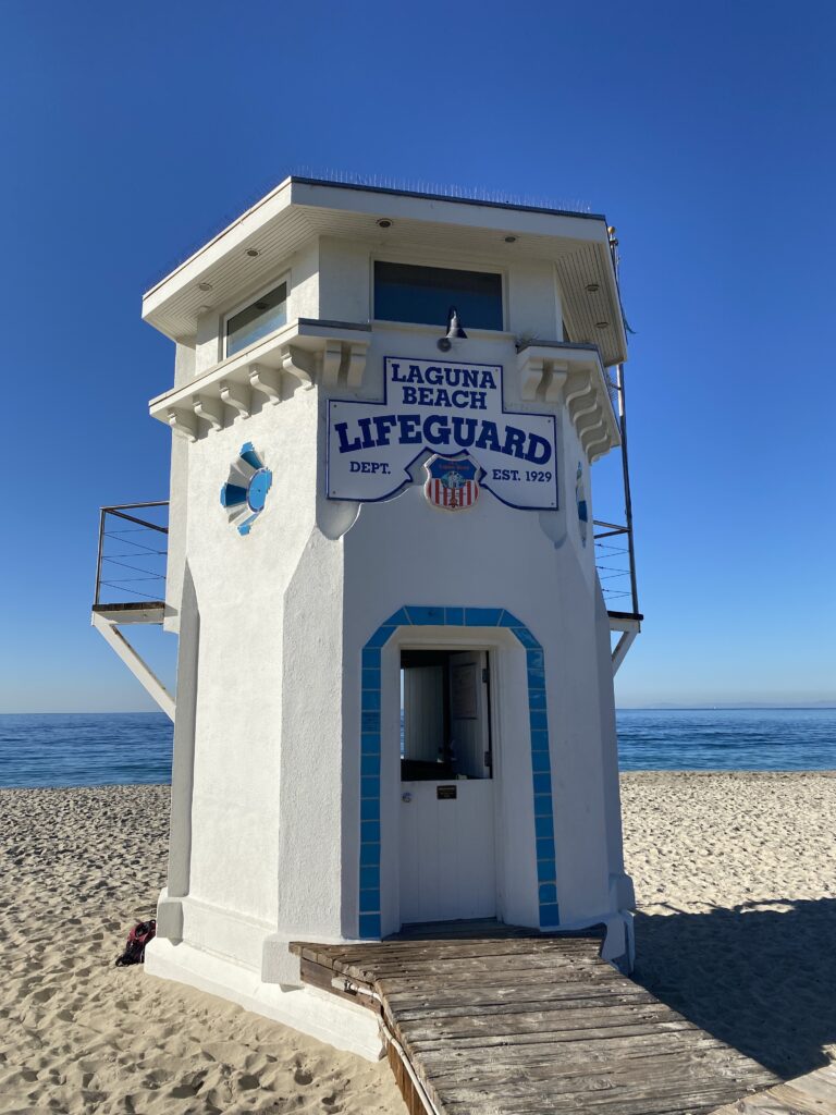
    Laguna Beach: Arts and Shopping

    Along Highway 101 or commonly known as PCH (Pacific Coast Highway) is the arts district of Laguna Beach.  The many galleries display a wide variety of art along with shopping and yummy restaurants.  The Pageant of the Masters (July-September), an outdoor show where real people recreate works of art along with the annual Sawdust Festival, an arts and crafts fair, is held here from June to August. 

    San Diego: Sea World, Old Town and Gas Lamp     

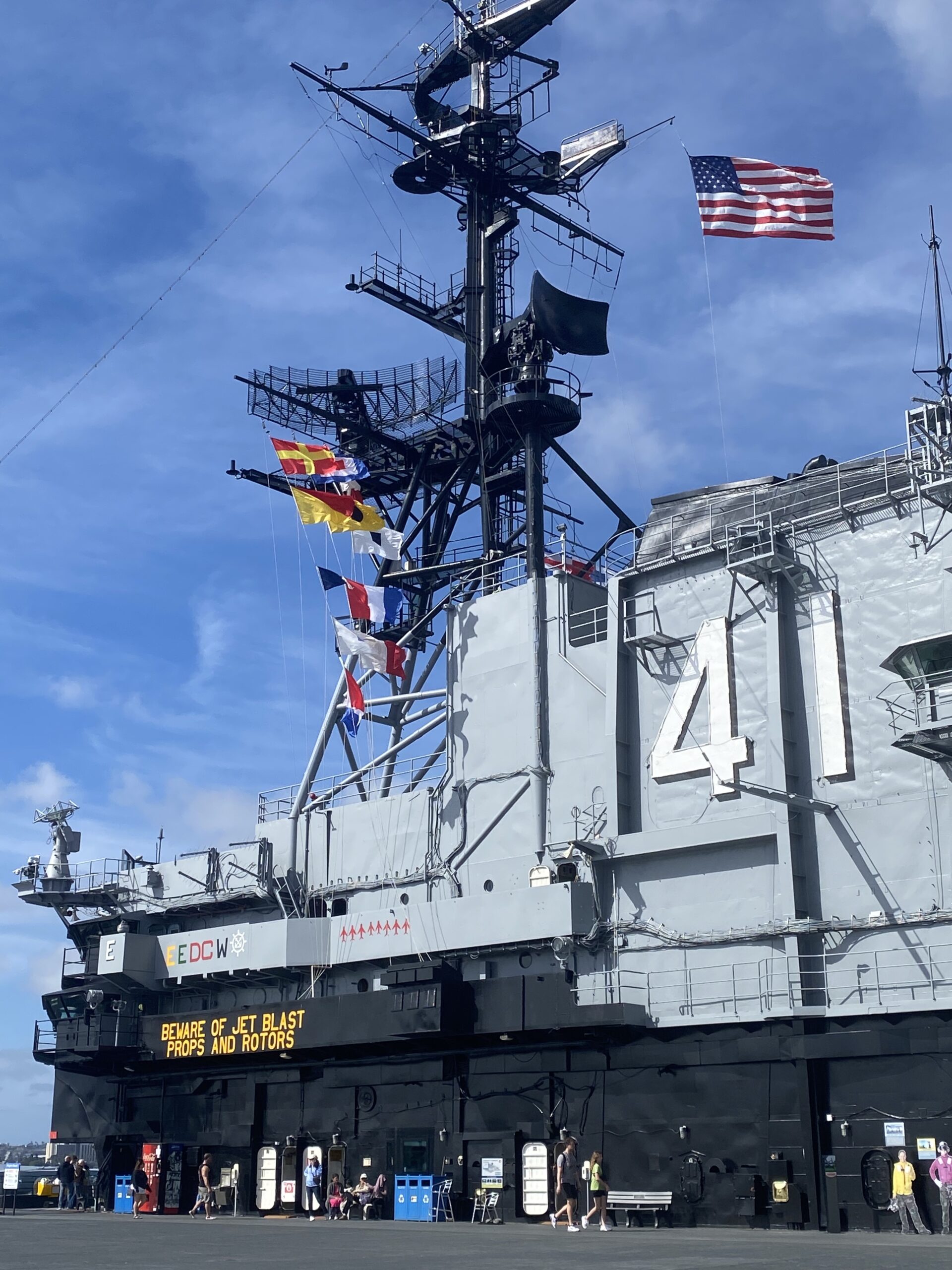
    San Diego is a huge city with many things to see and do.  During the last 30 years, the Gas Lamp district has undergone a renaissance and now has a large amount of stores and restaurants.  On Friday and Saturday nights, the streets are filled with people partying, slipping into the bars to hear music or just dancing along the sidewalks.  There are plenty of pedi-cars to take you from place to place but negotiate the price before you hop in.   In the Gas Lamp is also PetCo Stadium, home to the San Diego Padres Baseball Team. Also in San Diego’s Mission Bay is Sea World, the USS Midway Museum and in Old Town, you can visit 36 historical sites and museums, shops and restaurants. If you want a really nice night or Sunday Brunch, head on over to the Hotel Del Coronado. Its beautiful but pricey.

    That’s it San Francisco to San Diego or vice-a-versa.  Once you’ve finished this trip, try San Francisco to Seattle.  Its just as cool.  Promise…

    Link to the Map.

  • Death Valley National Park: Diverse Landscapes, Scenic Views & Must-See Attractions

    Death Valley National Park: Diverse Landscapes, Scenic Views & Must-See Attractions

    Within Death Valley, California, is the lowest elevation within the U.S. It’s also famous for being the hottest place on earth and driest place in North America. The world record highest air temperature of 134°F (57°C) was recorded at Furnace Creek on July 10, 1913.

    With these scorching temperatures, it’s advisable to stay away during the summer or a least make sure you are prepared with plenty of water. And, in the winters, it can be freezing and windy. So why go to this Hell hole?  Because time it right and it can also be gorgeous. The diversity in scenery within Death Valley National Park is hard to beat.  Within the National Park, you can see lavender and turquoise-colored rocks, sweeping sand dunes, a 600-foot crater and views that last forever.  There two main roads that travel through the park form a X, running north and south and if you have a 4-wheel drive or high-profile vehicle, you can access even more areas along the dirt roads. At the same time, please remember, this is a bio diverse area other animals and plants live here and as humans our goal is to leave no trace and take nothing but memories and photos with you.

    When we visited, it was a chilly March weekend and we drove the Corvette, so no off-roading for us but there was still plenty to see our two days here.

    Dante’s View


    This site is actually a little bit of a drive off the main road but still worth visiting.   The way there is curvy and mornings at the peak can be very cold and the windy.  Dante’s View is great for visiting in the morning and as the lookout is near the south end of the Park, looking out toward the north. You can literally see for miles through the valley to the mountains in the north. 

    Artist Drive

    This nine-mile loop road takes you to Artists Palette, which is probably the most Instagrammed location within the National Park.  The pinks, yellows, lavenders, turquoise and baby blue colored rocks form pastel rainbows that weave through the landscape.  These colors come from volcanic deposits rich in compounds such as iron-rich hematite that produce the reds and pinks along with the yellows and golds; manganese creates the lavender and chlorite create the greens.  

    Zabriskie Point

    If you like minimalist photography, this is the place to go.  The mountain ridges just repeat upon themselves making for layers upon layers of the same colors.  Each side from the parkway and short trail is different color.

    Ubehebe Crater Rim

    The Ubehebe Crater was formed 2,000 years ago when magma came into contact with groundwater.  The combination created a steam and gas explosion resulted in this 600-foot crater.  You can hike along the ridge.   

    Mesquite Flats Sand Dunes  

    There are too many places that are best visited at sunrise or sunset in Death Valley and since you only get one of each of these a day, it’s hard to pick.  I knew I wanted to see the shadows build upon the dunes so we toasted the day’s close here as the sun disappeared behind the mountains.  If your goal is the same, make sure you get here early as the mountains will hide the sun long before your phone says sunset occurs.

    Badwater Basin

    This location is the lowest elevation in the United States, 282 feet below sea level.  You can walk along the path of this salt flat and turn around to look at the sign high above that shows sea level.  What is sea level since the ocean’s water is constantly changing you might ask?  According to Nat Geo, because the ocean is one continuous body of water, its surface tends to seek the same level throughout the world. However, winds, currents, river discharges, and variations in gravity and temperature prevent the sea surface from being truly level. In the United States and its territories, local mean sea level is determined by taking hourly measurements of sea levels over a period of 19 years at various locations, and then averaging all of the measurements. 

    Because of its elevation, Badwater Basin will probably be the hottest place you experience in the Park.  Dante’s view will be the coolest at 5,575 ft (1,699 m) above sea level.

    Scotty’s Castle

    Just a note about Scotty’s Castle.  This “Castle” was “Scotty’s” folly in the middle of the desert but you can no longer get to it as the road is closed no matter which side you try to access it from. We wasted a few hours following the GPS just to find out that road was washed out years ago.

    Where to Stay

    There is camping within the Park and a variety of lodging opportunities but they fill up fast. Additionally, the Park is accessible from both California and Arizona.  We stayed at Longstreet Casino and RV Park in Amagosa Valley, AZ.  The rooms were clean and had balconies. Each night, they had entertainment in the bar area.  If you hate cigarette smoke, the bar is not for you but the outside grounds were nice.  Overall, I’d say this place was just okay but provided a good meeting place between AZ and CA.

    Death Valley is certainly worth another visit and I’d like to go camping and off-roading here to explore more of the Park. Additionally, I hear that stargazing on a cloudless, moonless night is fabulous.  Another reason to come back.

  • Hiking in Southeast Arizona (Part 2): Trails, Weather & Scenic Views Near Sierra Vista, Arizona

    Hiking in Southeast Arizona (Part 2): Trails, Weather & Scenic Views Near Sierra Vista, Arizona

    In Part II of your Southeast Arizona hiking guide, discover even more scenic trails and outdoor opportunities across this beautiful region. From cooler mountain elevations to wide-open desert views, Southeast Arizona is perfect for year-round hiking.

    Base yourself near Sierra Vista for easy access to top trailheads and diverse landscapes. During summer hikes, bring plenty of water and prepare for monsoon storms, while cooler months can bring sudden weather changes—so dress in layers and plan ahead.

    Enjoy safe, rewarding hikes while exploring one of Arizona’s most underrated outdoor destinations.

      Chiricahua National Monument

    For a weekend or longer get away, the Chiricahua National Monument offers hiking, camping and star gazing.  From Sierra Vista, it’s almost a two hour drive as the Monument runs close to the New Mexico border and is totally worth it.  The park is less busy than those in Northern Arizona.  We stayed in Bonita Canyon Campground but put our blow up mattress in the truck bed and at midnight headed up to the peak to look at the stars.  We were the only people in the parking lot and were rewarded with one of the most beautiful sunrises I’ve ever experienced. There are also plenty of hiking trails in the area.  If you’re planning on camping, make reservations ahead of time.

    Fairbank

    Fairbank, Arizona is a preserved ghost town.  Built in the 1880’s as a mining town,   there is an old outhouse, post office and some other buildings.  If you take the 5-mile loop walk, you’ll be rewarded with views from the small hilltop graveyard, old mill ruins. On the way back, the San Pedro River and old railroad tracks used to transport the ore out of the mine.  It’s a flat walk but can get quite warm so make sure to take plenty of water.

    San Pedro House and River

    The San Pedro House offers a two-mile, flat loop walk along the San Pedro River.  There is a picnic area and large trees to sit under.  When we went to hike the mosquitoes were out and impossible next to the river.  At non- summer times, it can be beautiful.

    Dragoon

    If you’re in the area, you must at least drive through the Dragoon Mountains.  They look like something out of Star Wars.  The rock formations are round rocks piled on top of each other. They offer hiking, camping in the area along with the scenic drive.

    Our Lady of the Sierras

    Built in the 1990’s, Our Lady of the Sierras has a huge cross and statue of the Virgin Mary.  It’s not really a hike but worth a stop. You can drive up almost to the top where you will see amazing views.  The shrine is located in Hereford, south of Sierra Vista.  There are two small parking lots.  The pavement is very steep when driving to o the upper one, so you might just want to park in the lower area and walk up the stairs. Read Part I

  • Standing on the Corner in Winslow, Arizona: Route 66 History, La Posada Hotel & Must-See Stops

    Standing on the Corner in Winslow, Arizona: Route 66 History, La Posada Hotel & Must-See Stops

    “Standing on the corner of Winslow, Arizona—such a fine sight to see…” The iconic lyric from Take It Easy, written by Jackson Browne in 1972 and made famous by Eagles, has turned Winslow into a must-visit stop for music lovers and road trippers alike. But beyond its pop culture fame, Winslow has long been an important travel hub, dating back to the rise of the railroads and its role along the historic Route 66—making it a classic destination for anyone exploring the American Southwest.

    Staying overnight at La Posada adds another layer to the experience, as the hotel has hosted notable guests like John Wayne, Amelia Earhart, James Stewart, and Franklin D. Roosevelt. Each room reflects a piece of history, and the on-site Turquoise Room offers a memorable dining experience with classic Southwestern cuisine and a nod to the original Harvey Girls tradition.

    In the 1880s, the Atchison, Topeka and Santa Fe Railway helped establish Winslow as a key stop for cross-country travelers heading west. Today, trains still pass through regularly, and visitors can even arrive via Amtrak. The town’s rich railroad heritage is beautifully preserved at La Posada Hotel, a restored Harvey House that originally opened in 1930. Designed by Mary Jane Colter, the hotel offers a unique blend of Southwest charm and historic elegance. Sitting on the back veranda with a drink in hand while watching trains roll by is an experience that perfectly captures the spirit of old Route 66 travel.

    No visit to Winslow is complete without a stroll through its charming downtown. Be sure to stop at Standin’ on the Corner Park, where you can snap a photo with statues inspired by the famous song—including a flatbed Ford and tributes to the musicians who made the town famous. Nearby shops and quirky photo ops, like a giant guitar and colorful street art, make this small town surprisingly lively. Whether you’re on a Route 66 road trip or just passing through northern Arizona, Winslow is more than a quick stop—it’s a nostalgic, worthwhile destination that captures a unique slice of Americana.

  • Bryce to Sedona Driving Itinerary

    Bryce to Sedona Driving Itinerary

    If you love the outdoors hiking through streams, seeing waterfalls, pine trees as well as cactus. And, if you love seeing a panorama of color from below your feet and soaring above your head. And, if you love taking in the outdoors, snapping photos and just relaxing in a lounge chair staring at the vista in front of you, Northern Arizona/Southern Utah is the place for you! The area is full of national parks, each one is beautiful in its own way. Below is an overview of some of your options. They are out of order but I’ve included a driving map to lead the way.

    The area is full of national parks, each one is beautiful in its own way. Below is an overview of some of your options.  They are out of order but I’ve included a driving map to lead the way. It’s at the bottom of this post.

    Arch in Arches National Park.

    Arches National Park:
    Arches is aptly named for its overabundance of rock arches, in fact the Park has more than 2,000 of them.  Within Devils Garden, spans Landscape Arch, which is the longest arch in North America extending 306 feet.  At its narrowest spot, it is only 6 feet in diameter. Double Arch is also worth a stop.  It soars 112 feet above ground and is 144 feet across. In Arches, there is a road that traverses through the park with many places to park along the way and walks that are easily accomplished by beginner and those with children.  More challenging hikes are also throughout the park and lead to some of the lesser visited arches. Stop by the Ranger Station ahead of time to pick up a pamphlet.  Camping is available but fills up quick.

    Antelope Canyon
    Horseshoe Bend

    Antelope Canyon and Horseshoe Bend: I visited Antelope Canyon five years ago and it was crowded but not crazy.  We went again last month, and that has changed.  It’s testament to social media’s influence.  Having said that, both are still worth a visit but be patient. There are people everywhere.  These sites are located in Page, Arizona, along the Colorado River and near Lake Powell.  Page was a sleepy little town but no longer.  There are plenty of hotels to choice from and some decent restaurants.  My favorite is a Mexican place called El Tapatio.  The service and atmosphere is terrific and the food good. Horseshoe Bend is where the Colorado River makes a U-turn around an outcropping of rocks.  We went during sunset but I think sunrise is probably less crowed.  There is a parking lot with bathrooms and the walk to the Bend is short, about 1.5 miles round trip.  

    Antelope Valley has been made famous because of its two canyons that are divided into Upper Antelope and Lower Antelope Canyon.  The colors of the sandstone rocks are orange and brown but a camera will change the colors depending upon how much light is hitting them, bright yellows for those with more light and deep purple for those in the shadows. Antelope Canyon is located on Navajo Indian land so you have to purchase a tour ticket to see them.  I suggest you do this before you leave because they do sell out.  There are a number of tour companies that are generally ran by just a few families.

    In Upper Antelope Canyon, rays of sun shine through the rocks creating beams of light that are particularly cool.  For this reason, we spend the extra money to do a photo tour of Upper Antelope Canyon. You need a DSL camera and you can take your tripod.  The guide will help you with the correct camera settings and making sure people don’t walk through your photo. They also know the exact time when the sun will shine through the rocks and will throw sand into the light beam making it more prominent on your photos. For this tour, you will take a short ride to site and then walk through the Canyon.

    The Lower Canyon offers tours too but because of the number of people and the ladders to go in, out and through the Canyon, tripods and backpacks are not allowed.  Our guide told us around 2,000 people a day go through Lower Antelope so expect lines and crowds.  Luckily, if you’re a photobug like me, you’re shooting up the entire time so you can easily crop people out.  Ask the guides ahead of time to set your camera, this works even if you’re shooting with a cell phone. 

    Note: Most tours require cash so be prepared. 

    Bryce Canyon

    Bryce Canyon:  Bryce Canyon has orange, white and red pinnacles called Hoodoos that soar throughout the park. If fact, Bryce has the largest collection of Hoodoos in the world.  In the winter, the Canyon often showcases a dusting of snow and it can get quite cold.  There is hiking, camping and a road that winds through it teasing you with a number of lookouts.    

    Zion Nattional Park

    Zion Canyon: Zion Canyon is one of my favorite National Parks.  It doesn’t have the colors of some of the other locations but its green, has a river and pine trees. You have to see the Great White Throne and Checkerboard Mesa.  We camped a few times here when I was a kid and I always have loved hiking through the woods and along the river. During peak season, you will need to park your car and ride the shuttle bus through the park. The shuttle buses are free and make many stops along the way.  You can hop on and hop off as you like taking hikes in between.  

    Grand Canyon

    Grand Canyon: Of course the Grand Canyon is the mother of all of the National Parks in this area and there are a number of ways to see it.  You can hike the Canyon both along the rim and at the bottom.  You can raft down the river (generally, you need to make reservations a year in advance for this), see it by train via Williams, Arizona, or drive through and stop along the way.  I’ve driven along the south side stopping and taking short hikes which are always fun and also taken the train from Williams to the Canyon for the day. No matter which you choose, the Grand Canyon is awe inspiring and literal took my breath away the first time I saw it.

    Flagstaff: You can’t write an article about this area without mentioning Flagstaff.  We always stay here along the route.  Flag, as the locals call it, has a quaint downtown with delicious food and a variety of hotels.  Last time we drove though, we stayed at the Hilton Garden Inn.  The hotel has a fireplace and cozy furniture so we ended up not leaving for dinner and just staying here reading in the lobby and getting dinner at the bar.  Another local restaurant I love in Flagstaff is Black Bart’s Steakhouse.  It’s a restaurant that caters to tourist but unlike other tourist restaurants, the food here is really good here. They have waiters and waitress that sing on stage in between serving your food.  A lot of them go to the local university and are really good. During the fall, Flagstaff has bright, yellow Aspens that dot the hills and it’s known for its skiing and snowboarding.

    Sedona: Sedona is the gateway to northern Arizona and southern Utah.  Here the red rocks start to pop out of the ground giving you a glimpse of the beauty to come.  People go to the Mesa Sedona Airport to view the sunset.  It costs $3 to park but worth the view as you look down upon the town.  Another place to visit here is the Chapel of the Holy Cross built in the side of the hill in 1956, the Chapel hangs over the cliff and you can walk through it.  Additionally, Sedona has hiking trails and you can take jeep tours through the area.  There are two state parks, Red Rock and Slide Rock.

    Meteor Crater

    Meteor Crater: A large hole in the ground doesn’t sound very exciting but we all agreed we really liked this excursion.  The Crater is nearly one mile across, 2.4 miles in circumference and more than 550 feet deep.  Tours for adults are $18 and kids are $9.  The price is really worth it as you walk around the Crater, the guide explains the geology of the rock, why they know it was a meteorite that caused it and how they proved it. 

    This trip never gets old and there is always something new to explore.  Have fun!

    Driving Map

  • Waco! The Heart of Texas Travel Guide: Things to Do and Explore in the Central Texas

    Waco! The Heart of Texas Travel Guide: Things to Do and Explore in the Central Texas

    Set along the banks of the Brazos River, Waco has quietly become one of Central Texas’s most overlooked destinations. Once known primarily as a college town and pit stop between Dallas and Austin, Waco now draws visitors with its mix of history, culture, outdoor spaces, and a rapidly growing food scene. Whether you’re planning a weekend getaway or just passing through, Waco offers a blend of small-town charm and big personality that’s well worth discovering

    Fix ‘er Up

    This not so little town (MSA around 270,000 people) has been lit on fire with the Chip and Joanna Gaines fixer upper television hit. The couple are not only creating their own intrinsic marketing campaign for Waco spurring tourism, they are also making a difference by renovating local old homes and commercial venues.  If you are even just a casual fan like me, you’ll want to visit Magnolia Market at the Silos. What once was an old grainery is now as home goods store; outdoor space with a bakery, Silos Baking Co.;food trucks and an outdoor space. If standing in line between 20 minutes to two hours for a muffin is not for you, then there are other restaurants within walking distance. We ate at Hecho en Waco. The food was delicious and the margaritas perfect. They were serving brunch but were happy to bring us a lunch menu. 

    You can also go down the road to the Gaines’ new restaurant Magnolia Table. My friend was there at the same time and opted for the two hour wait.  She said the food was really good. Note: It’s only open for breakfast and lunch and closed­ on Sundays.  Across the parking lot is Rudy’s County Store. We ate some delicious BBQ there where you get parchment paper for your plate, toss all your food on top and then proceed to gobble it up.  Delicious.

    50,000 Year Old Bones??

    Did you know a Woolly Mammoth and a Columbian Mammoth are not the same thing?  One of the biggest differences is that Columbian Mammoths are about 14 feet tall and Woolly’s areonly about 10 feet tall. If you are into old bones, you can see these creatures at the Waco Mammoth National Monument. Entrance is $5 and you get a 40-minute tour to see the excavation site housed under a metal building. You can also walk the grounds for free. There are hiking paths throughout the Park. 

    One of the Largest Municipally-Owned Parks in the U.S.

    Cameron Park is on 400 acres of land. Running through it is the Brazos River. Locals spend time on both the river and enjoying the beautiful views along the many hiking trails. We drove up to Lovers Leap to lookout over the city. The Park would be a great place to go kayaking or just relax with a picnic. 

    The Waco Suspension Bridge crosses the Brazos River and opened in 1870 as a

    part of the Chisholm Trail. Cowboys ran cattle across the bridge as they made their way from ranches in Texas to the railroad in Kansas. Currently, you can walk across the bridge and get some good photos of the river and other bridges. It’s a favorite place for prom and  quinceañera pics. 

    “I’m a Pepper, He’s a Pepper. We’re a Pepper. Be a Pepper. Wouldn’t you like to be a Pepper too?”

    Are you singing? Waco is home to Dr. Pepper. Charles Alderton, a pharmacist, spent most of his time mixing up medicine and serving carbonated drinks at the soda fountain. He liked the way the drug store smelled and wanted to make a drink that tasted like the smell. So if you think Dr. Pepper tastes like medicine, your right, it’s supposed to. The Museum costs $7.00 to enter and includes a small soda at the end or you can upgrade to an ice cream float and get a $1.00 credit towards your drink. 

    While we only had a short time in Waco, we had a fantastic time. We were lucky enough to have relatives to take us around the City filling us in on the history and details. If you’re visiting Dallas, or are a Fixer Upper fan, it’s worth a check out. 

    Bonus Trip

    Fort Worth Stockyards

    If you’re in Waco and looking for a day trip that adds some authentic Texas flavor, try visiting the Fort Worth Stockyards. The Stockyards offer a classic Western experience—retail shopping where you can pick up some boots and a cowboy hat; plentiful restaurants, because you’ll need some Texas BBQ to really get in the mood; and if that doesn’t get you saying Yee-haw!, twice a day the famous Fort Worth Longhorn Herd cattle are driven down the street twice daily (11:30 & 4:00)—an unforgettable sight that brings Old West history to life.

  • Arizona & Utah Road Trip Guide: National Parks, Antelope Canyon & Scenic Desert Views – No Filter Required

    Arizona & Utah Road Trip Guide: National Parks, Antelope Canyon & Scenic Desert Views – No Filter Required

    If you love outdoor adventures—hiking through streams, chasing waterfalls, wandering among pine trees and cactus, and taking in sweeping desert panoramas—then Northern Arizona and Southern Utah should be at the top of your travel list. From vibrant red rock landscapes to dramatic canyon views, this region offers some of the most photogenic scenery in the American Southwest—no filter required.

    The area is packed with world-famous national parks and natural wonders, each with its own unique beauty. Whether you’re planning a scenic road trip, a hiking getaway, or a photography-focused adventure, destinations like Grand Canyon National Park, Zion National Park, and Bryce Canyon National Park offer unforgettable experiences. Add in iconic stops like Antelope Canyon and Horseshoe Bend, and you’ve got the perfect mix of adventure, relaxation, and jaw-dropping views.

    Below is an overview of some of the best places to visit in Northern Arizona and Southern Utah to help you plan your route and make the most of your trip.

    They are out of order but I’ve included a driving map to lead the way. 

    Arches National Park: Arches is aptly named for its overabundance of rock arches, in fact the Park has more than 2,000 of them.  Within Devils Garden, spans Landscape Arch, which is the longest arch in North America extending 306 feet.  At its narrowest spot, it is only 6 feet in diameter. Double Arch is also worth a stop.  It soars 112 feet above ground and is 144 feet across. In Arches, there is a road that traverses through the park with many places to park along the way and walks that are easily accomplished by beginner and those with children.  More challenging hikes are also throughout the park and lead to some of the lesser visited arches. Stop by the Ranger Station ahead of time to pick up a pamphlet.  Camping is available but fills up quick.

    Antelope Canyon and Horseshoe Bend: I visited Antelope Canyon five years ago and it was crowded but not crazy.  We went again last month, and that has changed.  It’s testament to social media’s influence.  Having said that, both are still worth a visit but be patient. There are people everywhere.  These sites are located in Page, Arizona, along the Colorado River and near Lake Powell.  Page was a sleepy little town but no longer.  There are plenty of hotels to choice from and some decent restaurants.  My favorite is a Mexican place called El Tapatio.  The service and atmosphere is terrific and the food good. Horseshoe Bend is where the Colorado River makes a U-turn around an outcropping of rocks.  We went during sunset but I think sunrise is probably less crowed.  There is a parking lot with bathrooms and the walk to the Bend is short, about 1.5 miles round trip.  

    Antelope Valley has been made famous because of its two canyons that are divided into Upper Antelope and Lower Antelope Canyon.  The colors of the sandstone rocks are orange and brown but a camera will change the colors depending upon how much light is hitting them, bright yellows for those with more light and deep purple for those in the shadows. Antelope Canyon is located on Navajo Indian land so you have to purchase a tour ticket to see them.  I suggest you do this before you leave because they do sell out.  There are a number of tour companies that are generally ran by just a few families.

    In Upper Antelope Canyon, rays of sun shine through the rocks creating beams of light that are particularly cool.  For this reason, we spend the extra money to do a photo tour of Upper Antelope Canyon. You need a DSL camera and you can take your tripod.  The guide will help you with the correct camera settings and making sure people don’t walk through your photo. They also know the exact time when the sun will shine through the rocks and will throw sand into the light beam making it more prominent on your photos. For this tour, you will take a short ride to site and then walk through the Canyon.

    The Lower Canyon offers tours too but because of the number of people and the ladders to go in, out and through the Canyon, tripods and backpacks are not allowed.  Our guide told us around 2,000 people a day go through Lower Antelope so expect lines and crowds.  Luckily, if you’re a photobug like me, you’re shooting up the entire time so you can easily crop people out.  Ask the guides ahead of time to set your camera, this works even if you’re shooting with a cell phone. 

    Note: Most tours require cash so be prepared. 

    Bryce Canyon:  Bryce Canyon has orange, white and red pinnacles called Hoodoos that soar throughout the park. If fact, Bryce has the largest collection of Hoodoos in the world.  In the winter, the Canyon often showcases a dusting of snow and it can get quite cold.  There is hiking, camping and a road that winds through it teasing you with a number of lookouts.    

    Zion Canyon: Zion Canyon is one of my favorite National Parks.  It doesn’t have the colors of some of the other locations but its green, has a river and pine trees. You have to see the Great White Throne and Checkerboard Mesa.  We camped a few times here when I was a kid and I always have loved hiking through the woods and along the river. During peak season, you will need to park your car and ride the shuttle bus through the park. The shuttle buses are free and make many stops along the way.  You can hop on and hop off as you like taking hikes in between.  

    Grand Canyon: Of course the Grand Canyon is the mother of all of the National Parks in this area and there are a number of ways to see it.  You can hike the Canyon both along the rim and at the bottom.  You can raft down the river (generally, you need to make reservations a year in advance for this), see it by train via Williams, Arizona, or drive through and stop along the way.  I’ve driven along the south side stopping and taking short hikes which are always fun and also taken the train from Williams to the Canyon for the day. No matter which you choose, the Grand Canyon is awe inspiring and literal took my breath away the first time I saw it.

    Flagstaff: You can’t write an article about this area without mentioning Flagstaff.  We always stay here along the route.  Flag, as the locals call it, has a quaint downtown with delicious food and a variety of hotels.  Last time we drove though, we stayed at the Hilton Garden Inn.  The hotel has a fireplace and cozy furniture so we ended up not leaving for dinner and just staying here reading in the lobby and getting dinner at the bar.  Another local restaurant I love in Flagstaff is Black Bart’s Steakhouse.  It’s a restaurant that caters to tourist but unlike other tourist restaurants, the food here is really good here. They have waiters and waitress that sing on stage in between serving your food.  A lot of them go to the local university and are really good. During the fall, Flagstaff has bright, yellow Aspens that dot the hills and it’s known for its skiing and snowboarding.

    Sedona: Sedona is the gateway to northern Arizona and southern Utah.  Here the red rocks start to pop out of the ground giving you a glimpse of the beauty to come.  People go to the Mesa Sedona Airport to view the sunset.  It costs $3 to park but worth the view as you look down upon the town.  Another place to visit here is the Chapel of the Holy Cross built in the side of the hill in 1956, the Chapel hangs over the cliff and you can walk through it.  Additionally, Sedona has hiking trails and you can take jeep tours through the area.  There are two state parks, Red Rock and Slide Rock.

    Meteor Crater: A large hole in the ground doesn’t sound very exciting but we all agreed we really liked this excursion.  The Crater is nearly one mile across, 2.4 miles in circumference and more than 550 feet deep.  Tours for adults are $18 and kids are $9.  The price is really worth it as you walk around the Crater, the guide explains the geology of the rock, why they know it was a meteorite that caused it and how they proved it. 

    This trip never gets old and there is always something new to explore.  Have fun!

  • Discover Southeast Arizona: Stunning Landscapes, Cooler Summers, and Fewer Crowds

    Discover Southeast Arizona: Stunning Landscapes, Cooler Summers, and Fewer Crowds

    Arizona is known for its brilliant sunsets, colorful rock formations, and warm desert nights. While many travelers head north of Phoenix to visit the iconic Grand Canyon and the tri-state region, one of the most beautiful—and often overlooked—areas of the state lies in Southeast Arizona.

    This region offers the same dramatic landscapes and desert beauty, but with far fewer crowds. If you’re looking for a more relaxed Arizona travel experience filled with scenic views, outdoor adventures, and peaceful desert towns, Southeast Arizona is a perfect destination.

    Why Visit Southeast Arizona?

    Whether you’re planning a quick weekend getaway or a full week of exploring, Southeast Arizona offers plenty to see and do. From scenic drives and hiking trails to wildlife watching and historic towns, the region provides a diverse desert experience.

    One of the best times to visit is summer. While many parts of the country experience humid heat, Southeast Arizona stays noticeably cooler thanks to its higher elevation. When temperatures climb to 112°F in Phoenix and around 102°F in Tucson, towns like Sierra Vista often remain in the low 90s, making outdoor exploration much more comfortable.

    Summer Monsoons and Desert Rainbows

    Rainbow

    Summer also brings one of the region’s most spectacular natural events—the Arizona monsoon season. Afternoon storms roll dramatically across the desert sky, creating incredible lightning shows, cooling rains, and some of the most vibrant rainbows you’ll ever see. For photographers, nature lovers, and anyone who appreciates dramatic skies, Southeast Arizona in the summer is unforgettable.

    A Hidden Gem Worth Exploring

    From cooler mountain towns to wide-open desert vistas, Southeast Arizona offers a side of the state that many travelers miss. With fewer tourists, breathtaking scenery, and unique summer weather, it’s a destination that truly has something for everyone.

    Having lived in Sierra Vista, here are some of my recommendations. 

    Cave Dwellers

    Between Interstate 10 at Benson and Sierra Vista, you can visit Kartchner Caverns State Park, voted as one of the top 10 caves in the U.S., Kartchner Cavern is an actually living cave.  This means its’ still growing and changing with stalagmites and stalactites.  They have two tours, one of which the highlights is the throne room and Kubla Khan, the largest column formation in Arizona. 

    Check the website  before you go as tours can be limited when the bats are hibernating.  You might also want to buy your tickets on line as they are often sold out.   The Cave was discovered in the 1970’s and is very much protected so you can’t take photos inside.  They also offer camping.

    Wanna be Cowboys and Cowgirls

    Tombstone Cemetery

    Southeast Arizona is home to the OK Corral located in Tombstone.  This is where Wyatt Earp and the Earp brothers had their last shoot out.  Personally, I’m partial to Doc Holliday.  It may just be the blockbuster movie with Val Kilmer, Curt Russ and Sam Elliott but I really appreciate Doc’s attitude toward life.  I digress.  While a little touristy, Tombstone is alive and well with boots, spurs, horses and shootouts every day.  There are shows for the kids and history lessons for the adults.  If you have teenagers, I recommend watching the movie before you go. (It’s R rated.)  My kids loved seeing the buildings they watched on tv the night before and it provided them some context for their visit.  To get the real feel of the town, I recommend going to the Big Nose Kate’s for a sassafras (rootbeer).  They’ll make a float if you ask them. Kate is reported to be the first prostitute in Tombstone and she was Doc’s girlfriend.   Also, the Bird Cage Theatre has a museum.  There are more than 140 bullet holes in the building. 

    The admittance is a little pricey but they give discounts to families.  Skip the graveyard in Tombstone and instead visit Boot Hill on the edge of town.  It’s got a view and its fun to look at all of the old grave stones.  Prices range from $9 to $12.

    Miners

    f you never been in a mine, Bisbee is where you want to go.  The town is built on the side of a mountain and takes you back to the 1880 with gold, copper and silver.  Before entering or while leaving the town, visit the Lavender Pit.  While you wouldn’t think much of a hole in the ground but it has lots of beautifully colored rocks.  It also gives you a sense of how devastating mining was to the environment in the old days. 

    Photo of Lavender Mine

    I

    I Before you go, reserve a tour ticket for the Queen Mine Tour.  You don’t have to pay online but they may be sold out for the day.  The mine tour takes you down 1,500 feet via a mining tram car. My 10-year old nephew loved wearing the hard hat, miners light and jacket.   Beware though it is not for the claustrophobic.    Afterward, head to the town and walk the vintage antique shops. If there your there for breakfast, I’d recommend Ana’s Seasonal Kitchen.  The restaurant is very small but the food is amazing.  I had pancakes with bananas and a sauce that was to die for.  Other good places for lunch or dinner are Café Roka, a little pricy but good and Santiago’s for Mexican food.  I’ve also had burgers at the Copper Queen and they are good for bar food.  You can sit on the patio and watch people walk by.

     Star Gazers

    No matter where you visit, if you’re from the city, get out of town one night and drive toward the darkness. It doesn’t really matter where, there are plenty of places to pull off the side of the road.  I suggest heading east.   Find a place to park before the moon comes up and enjoy the starry, starry night!

    History Buffs

    Cemetary at Fort Huachua

    Visit Fort Huachuca!  The Fort is an army post and is home to all of the Buffalo Soldier regiments.  The Fort originated in 1877 to stop the Apache raiding parties from Mexico.  Geronimo surrendered in the area and had his last hide out in Southeast Arizona.  Regardless of your political beliefs, the history is fascinating as well as the current missions of the Fort that include:  unmanned aerial systems, intelligence, cybersecurity and electronic warfare.  The Fort has two museums focusing on military intelligence and the Buffalo Soldiers. 

    If you’re a U.S. resident with ID, you can get a day pass to get onto the facility pretty quickly.  Go to the Van Deman gate.  There is a trailer off to the side.  You can tell the guard you are there to visit the museum.  If you’re not a U.S. resident, you should call ahead. For more information, visit:  http://huachuca-www.army.mil/pages/des/accesscontrol.html. Note: Access may have changed since this post was written.

    Where to Stay

    Sierra Vista is the best place to stay. It’s in the middle of everything and you can road trip it from there.  It offers all of the hotel brands but if you want a clean non-brand hotel, try Sierra Suites.   If you’re looking for something more eclectic, stay in Bisbee, there a number of old hotels within the downtown area.  The most famous is the Copper Queen although I’ve never stayed there. It was built in 1880 by the Phelps Dodge Mining Company and like a lot of old hotels is reported to be haunted.   Bisbee is also known for its weekend music scene; you can walk to most places if you stay downtown.

    Bisbee Hotel

    Websites

    www.explorecochise.com

    www.visit.sierravistaaz.gov

    www.bisbeeaz.gov

    www.tombstoneweb.com