Alaska is a beautiful state with its tall leggy spruce trees, pretty summer flowers in purples, pinks, blues, yellows, whites and reds. Immense black peaks with sprinkles of white snow and glaciers that play hide and seek disappearing behind white and black clouds, only to reappear to shiny blue skies. Shades of green are everywhere. The air smells clean and flowing braided rivers flow along the highways and trails. The allure is present everywhere and I can understand while so many people came and just never left. We hear that from more than one local, starting with our waiter at the restaurant who came up to work a summer and just stayed; to our bus driver who now rents a homestead without electricity and an outhouse. He tells us, I left after one summer and Alaska kept calling me back. I get it. Even though it’s summer and I know the winters are harsh up here but Alaska has permeated through my skin and eyes and gotten into my bones and I don’t want to leave. I’m not ready to go back to the harsh sounds of the city. I will leave a piece of my heart here.
This trip is my third time to this gorgeous state and while I wasn’t going to get to see the Northern lights, having 20 hours of daylight allows for a lot of time to see other sights.
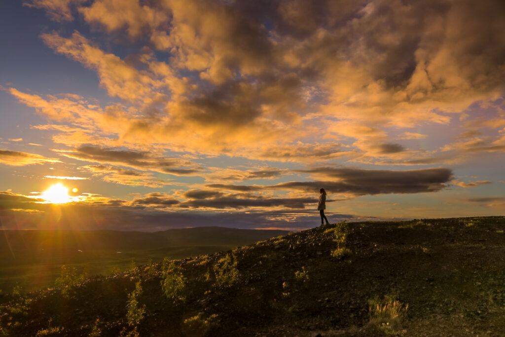
I took a late after-work flight out of LAX and met my boyfriend In Anchorage just in time to see the sunset, at midnight!
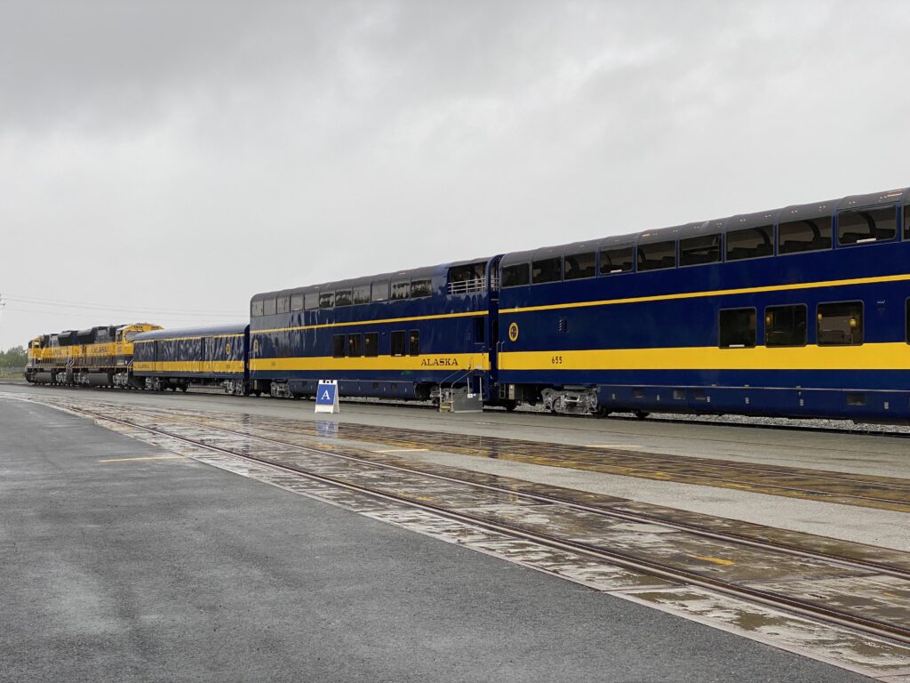
We got up blurry-eyed at 5:00 am to be at the Alaskan Railroad train station before 6:00 to go to Seward. The Alaskan Railroad train is a four-hour ride from Anchorage to Seward. Along the way, you pass through beautiful county, snowy mountains, black muddy lakes the shiny aqua gray, tall pines and wildlife. A narrator will fill you in on Alaskan history and tells everyone when to jump up and run to one side of the train to spot a bear, moose or bald eagle.
Seward
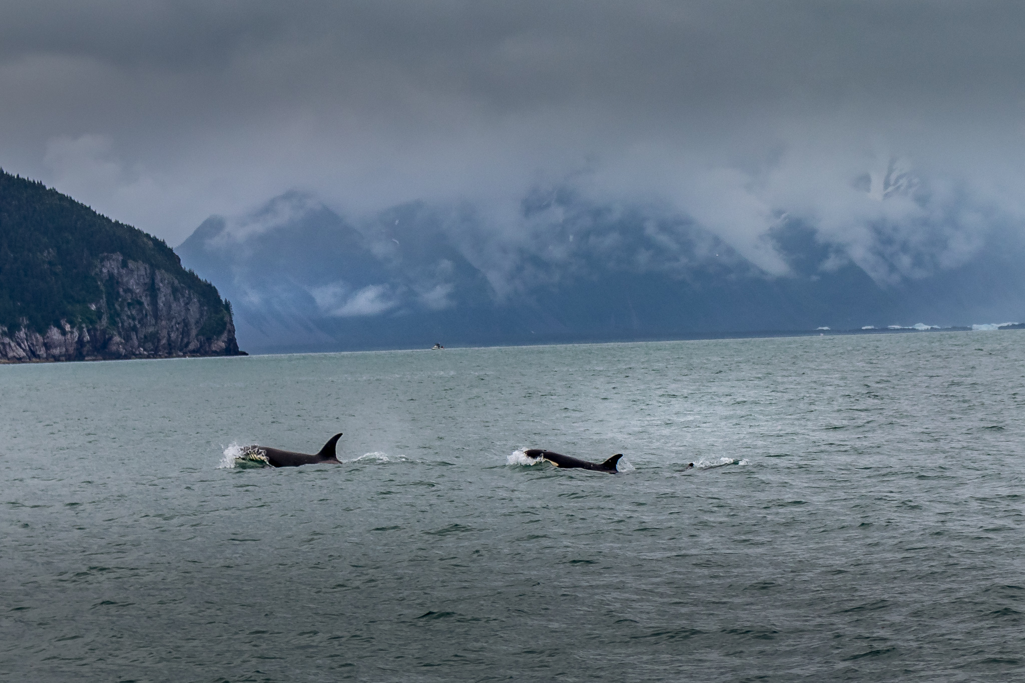
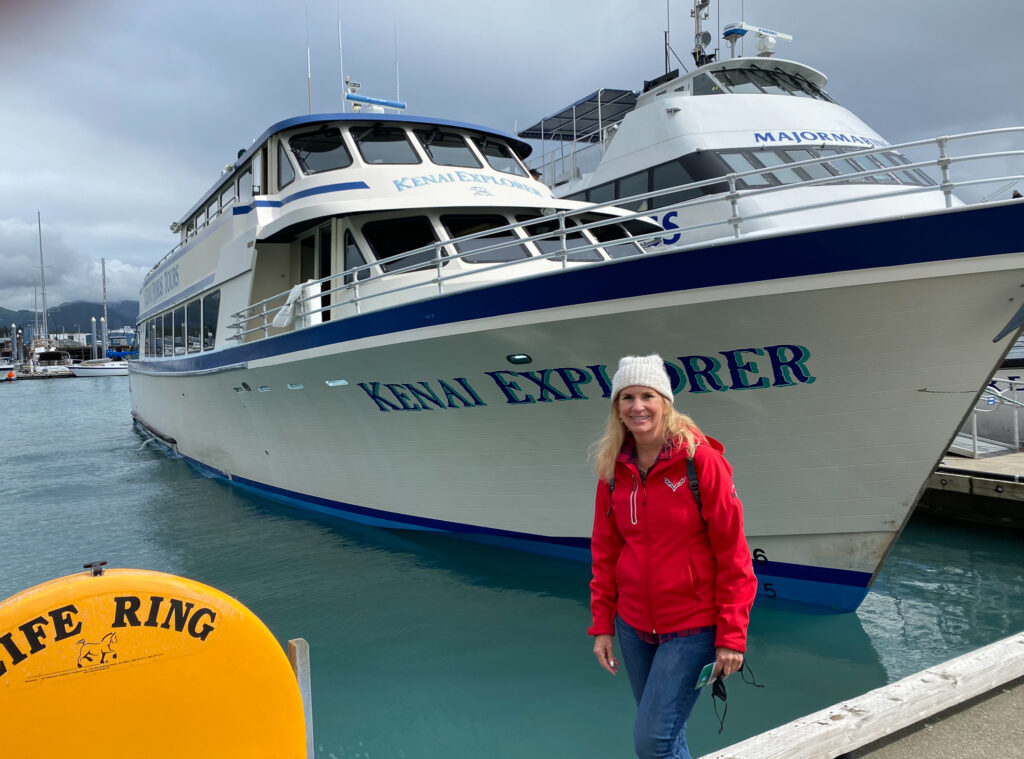
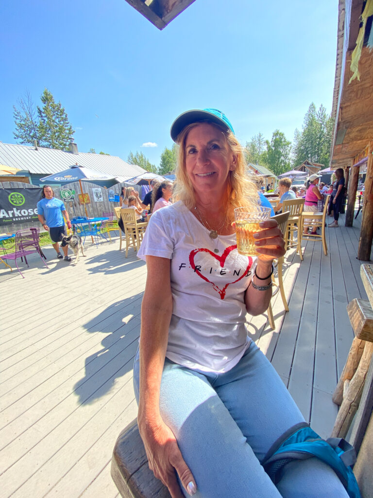
Once in Seward, we hopped on a Kenai Fjords Tours boat for a day cruise. This is the second time we’ve booked with Kenai and they do an excellent job. Last time we went on a short boat ride and had so much fun, this time I booked us for a six-hour tour. It was a cold raining day but I still couldn’t resist freezing while standing on the bow of the boat as we bounced over the rolling swells. We first visited Fox Island, which was named to entice fox farming in Alaska. That didn’t quite work out but the Island is now a local tourist destination offering lunch. Salmon cakes, yum! Afterward we walked along a shoreline covered with shale like skipping rocks. Having finished, we all scrambled back to the boat ready for sightseeing. We saw more bald eagles and were enjoying cute little puffins when someone sighted two slim line black fins gliding through the water – Orcas! We followed them for a bit when the captain got a call from another boat about a pod of humpbacks. Reeving up the engines we took off to find whale spouts. There was a Momma and a baby swimming behind another eight or so whales. At one point, their heads came up right in front of the boat! These are some of the largest mammals on earth weighing in at 50 tons and up to 50 feet long. Hint: If you look for where the birds are congregating, you can usually know where the whales are hiding under the water.
Running out of time, we sadly headed back to port and the train ride back to Anchorage, napping on the way back.
Ninja tips: The train leaves Anchorage at 6:50am and comes back at 6:00pm. There was a shuttle when we got off to take us to the port and back again, which was great but there was no time in between to walk around. On the train, there is a cafe that offers drinks and limited food service. If you have Goldstar tickets, you sit in luxury cars and can go to the dining car. We didn’t purchase these as they are pretty expensive. The last car has an open-air balcony to stand on.
Talkeetna
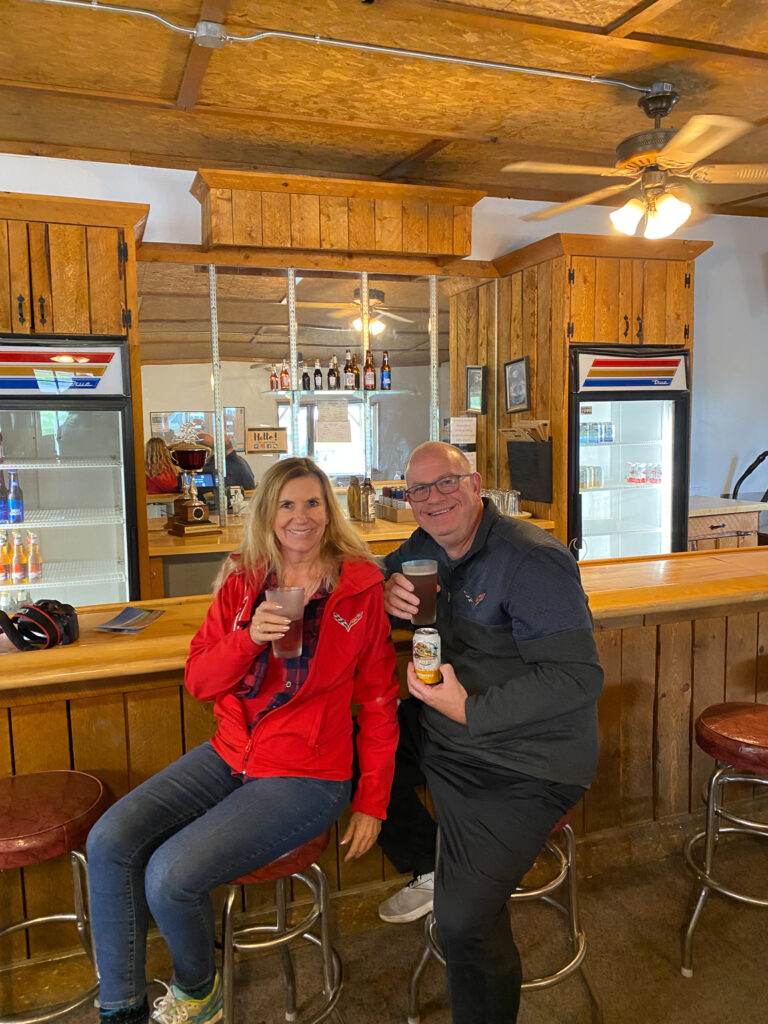
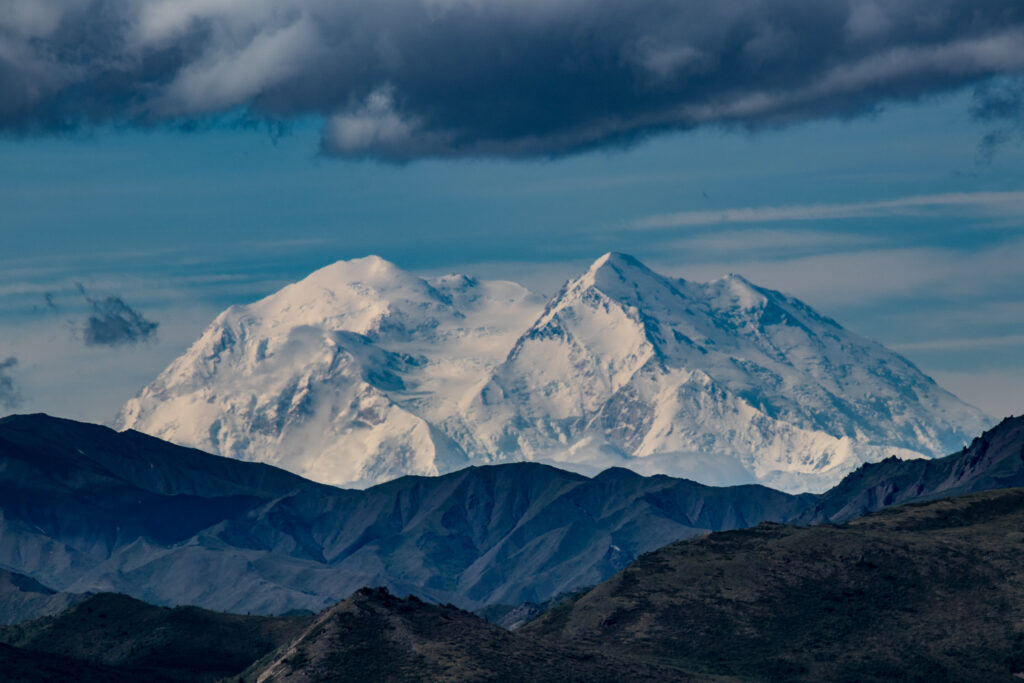
We rolled into Talkeetna on July 4th. The town was full of locals and visitors enjoying a lovely sunny Alaskan day. You could actually see the top of Denali (Mt. Whitney) and shorts and t-shirts were acceptable clothing.
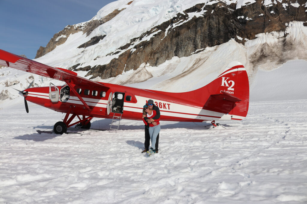
Talkeetna is a small town and terribly cute. The Downtown consists on a few blocks of shops selling unique and touristy goodies. I just had to go into all of them while my Mike waited outside. While we waited for our next Alaskan adventure, a flight and landing on an actual glacier!, we had a couple of drinks at the bar along with a slice of pizza at Mountain High Pizza. You can order by the slice and pick your own toppings.
At K2 Aviation, we met our pilot Chad, who provided a safety briefing. When he asked who wanted the co-pilot seat, I quickly raised my hand. We had a 5% day, which means only 5% of the year do you get a day where you can see the top of Denali. This equates to about 18 or less days a year. Because the weather was perfect, we flew all the way around to the backside of Denali. It’s impossible to understand the scale of the mountains even from the air. Denali is 20,000 feet high and we flew at 14,000 feet. Below were glaciers, huge crevasses that looked like tiny tears in a piece of material and bright teal blue pools. Chad skillfully landed us right on the glacier where we got out, played in the snow and took photos. There are no words that explain how beautiful it was.
We stayed at Talkeetna Wilderness Lodge, cute little cabins on a forested area. Susan was great, contacting me in the morning with final reservation information and I was welcomed with my name on the cabin.
Also, there south of Talkeetna is Alaska Wild Harvest where they tap Birch trees to make syrup. We didn’t stop here this time but have before and had fun tasting different syrup vintages. It’s interesting how much the taste changes during the years.
Ninja tips: I checked the weather and rescheduled our flight at the last minute knowing the day we supposed to fly, rain was predicted and luckily, they had an opening. All the restaurants in Talkeetna closed by 8:00 PM and we were starving. Luckily the Talkeetna Alaskan Lodge was still opened.
Fairbanks
After breakfast at the Flying Squirrel Bakery & Cafe. I had a Sunrise Breakfast that consisted of bread, with an egg, spinach and a delicious sauce.
From Talkeetna, we drove to Fairbanks. It’s a six-hour drive and somehow we always manage to make these longer than the time stated on the map. We rolled in looking for dinner at the Bakery Restaurant. It’s one of those cafes where everything and more is on the menu and my Ruben sandwich was pretty good.
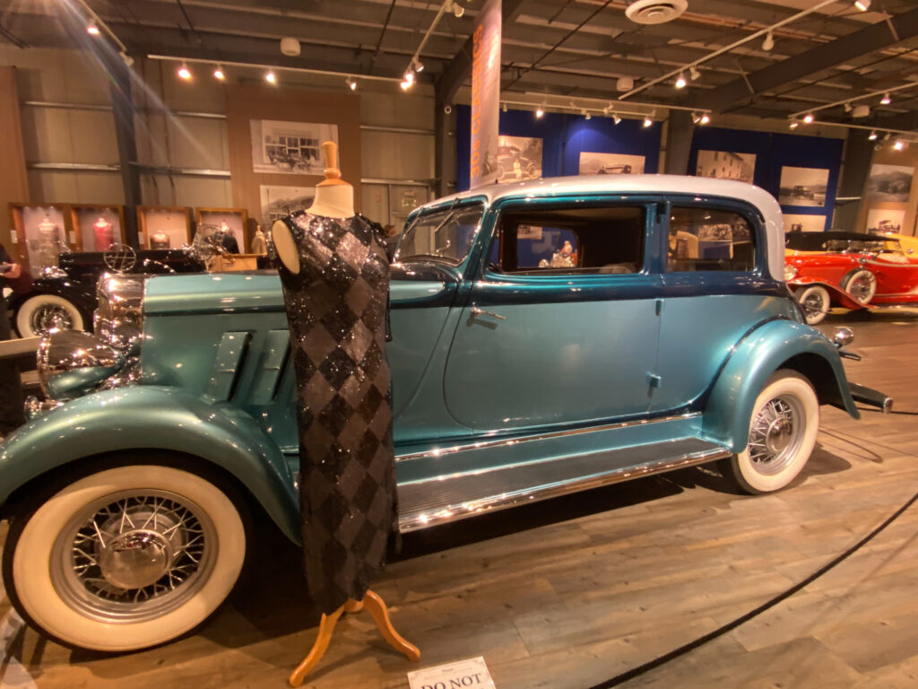
The next day, being wiped out, we took it easy and started our day with a walk along the river. Not sure what we wanted to do, we selected the Fountainhead Auto Museum. Score! They have a huge, pre-WW2, all-American car museum. The cars are immaculate, being restored to their former beauty. My favorite was a baby blue 1933 Hupmobile. The paint’s shine was created by adding fish scales to the paint. The museum is brilliant in that there are a lot of cars for the automotive enthusiasts and on top of that includes one of my loves, vintage dresses that are from the same time period as the car. Mike and I were both happy.
Afterward, we had a large leisurely lunch with a glass of wine at Giraldo’s Italian Kitchen. My lasagna was really good. We followed it up with a drive out to the Chena River and State Park where we saw a Bald Eagle hunting for fish and fought off swarms of mosquitoes. Fun Fact: Caribou in Alaska can lose a pint a blood a day due to these tiny beasts.
Calling it quits early, we went back to the room to get ready for the next day, traveling to the Arctic Circle.
Artic Circle
Before going to the Fairbanks Airport to catch our flight through the Northern Alaska Tour Company, we wanted to fill our bellies so we pulled up to a bar that was highly recommended and didn’t look like much but boy, the Oasis Restaurant and Lounge, was delicious. I had an omelet with ham and hollandaise sauce along with biscuits and sausage.
Our next adventure was an all-day tour. When I say all day, I mean we met at noon and didn’t get bank to our room until 3:30 am. The trip included a plane ride into Cold Foot, a worker’s camp with a restaurant, post office and a place where you could rent a room for the night. It earned its name by being the location where miners looking to make their fortune would get cold feet and turn around to go home. As we flew to Cold Foot, you could see the mighty Yukon River and miles of the Trans Alaskan Pipeline.
In Cold Foot, you can purchase lunch but having already eaten, we opted for a local beer in the bar. I love bars for the comradery and interesting people. While here we talked to a guy who was riding his bike alone the Pan-America Highway all the way from Alaska to Argentina. He estimated that would take him two years!
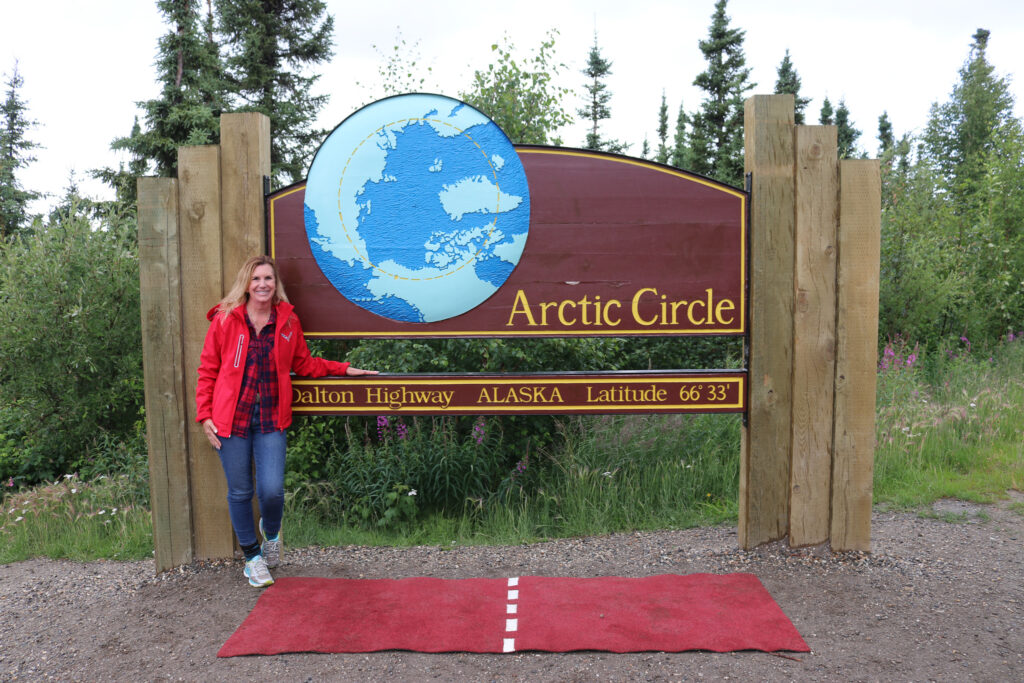
From Cold Foot, we drove south to the Arctic Circle, about two and half to three hours, which precisely located at the 33’ 66” longitude. The road is really rough and we ended up in the back of the van. I was wishing for my old kidney belt most of the way and our driver, Steven, entertained us with stories about living in Alaska.
The Arctic Circle This is where during the summer solstice, the first day of summer and the longest day of the year, the sun never sets lower than the horizon. Likewise, on the first day of winter, the sun never comes up. It’s because of the tilt of the earth and how it rotates on its axis. Hence the phrase, Land of the Midnight Sun.
Leaving the Arctic Circle, we changed vehicles to a nicer touring bus and headed back. The trip was another seven hours drive back to Fairbanks along the Dalton Highway made specifically for the Alaskan Oil Pipeline for more than 800 miles and wide vista views.
We made stops along the way to check out the permafrost, soil that has remained frozen for more than two years and to cross the only bridge across the Yukon River in Alaska.
We watched the sun set at 12:30am and the sun was rising when we got back at 3:30am.
Overall, I would change out this trip and take the plane up, spend the night to see sunset and sunrise and then either drive back or fly back the next day. Tomorrow, Denali National Park.
Denali National Park
Denali National Park’s primary purpose was to set aside 6.1M acres of land to protect animals and nature from humans, keeping tourism imited. You can’t drive further into the Park than 19 miles unless you were lucky enough to snag one of the very limited campsites but that doesn’t mean Denali National Park it’s not worth seeing. Very much the opposite.
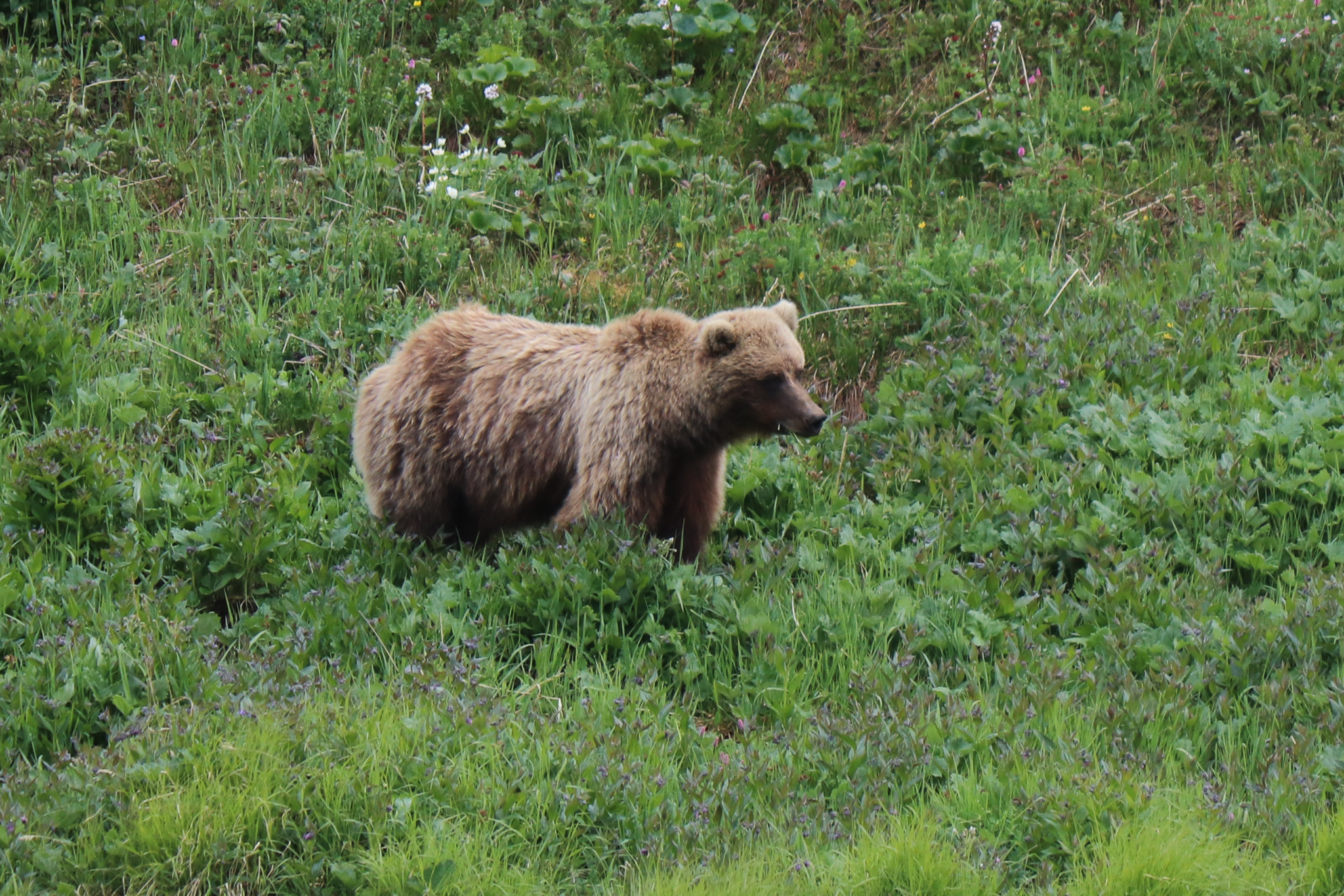
You can book bus tours deeper into the Park with varying lengths of time. We selected the eight- hour tour and while that seems like a long time, it didn’t feel like it, giving us about six hours in the actually Park. All along the way, Brian, our guide who is a trained botanist, stopped and explained park conservation, the animals and the names and medicinal uses of the flowers. We were lucky enough to have another gorgeous day and we’re able to see all of Denali. This only happens about a few days a year so definitely buying a lotto ticket soon. We saw bears, Dahl sheep, elk, a moose and a marmot.
We stayed at The Grand Denali Lodge, which sits high on the hill and you can’t miss it. From our room, we looked over the entire valley.
Food in Denali was limited. They, like everyone else, are having troubles finding workers after the pandemic. The Lodge was serving dinner and we ate lunch and one of our dinners at Karsten’s Public House located in McKinley Chalet Resort. I’m the evenings they have music and fire pits that you can sit outside and enjoy.
Ninja hints: On the bus, sit on the driver’s side. The views are better on the way up and pick a seat with a window so you can open it and not have to take photos through the glass. Also, if you react to mosquito bites, pack bug spray as they are everywhere.
I loved our third trip to Alaska and will come back for many more, particularly for the Northern Lights and fishing.
Alaska is calling and I’m definitely going to answer back.